1Wonder Expedition

trekking and hikking

Kilimanjaro Trekking
trekking and hikking

Kilimanjaro Trekking – Lemosho Route (8 Days)

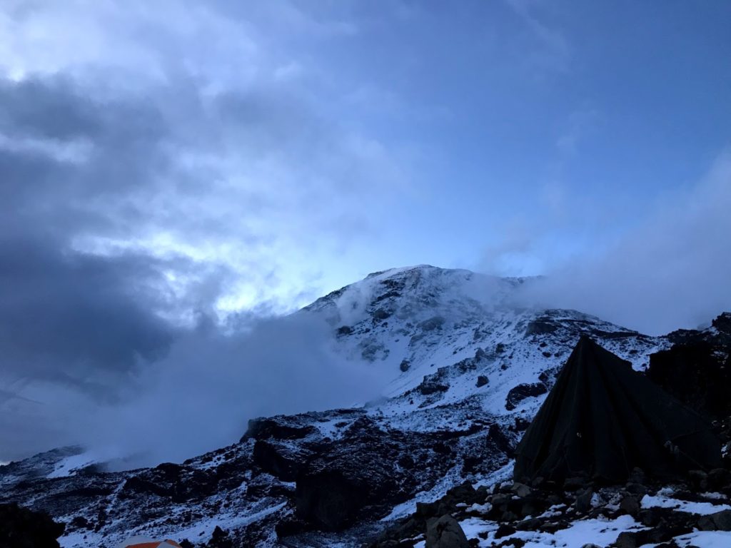
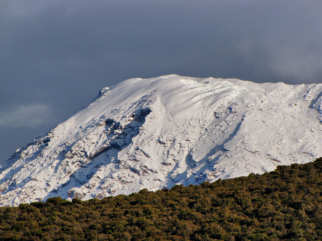
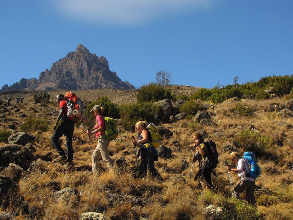
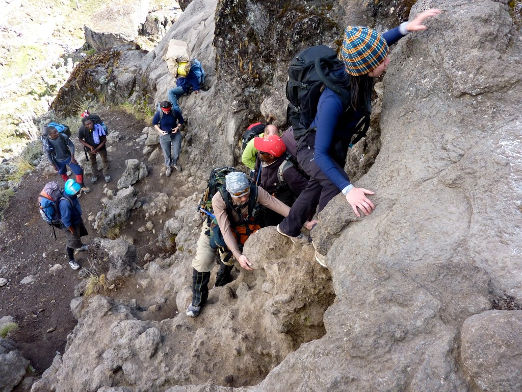
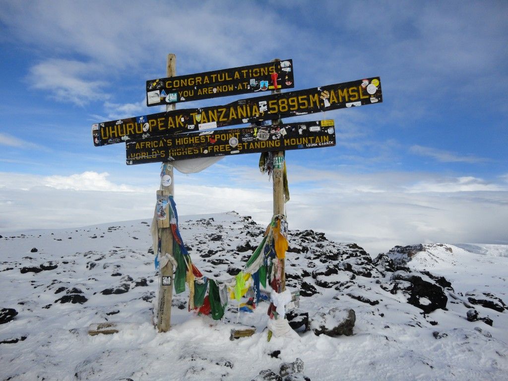
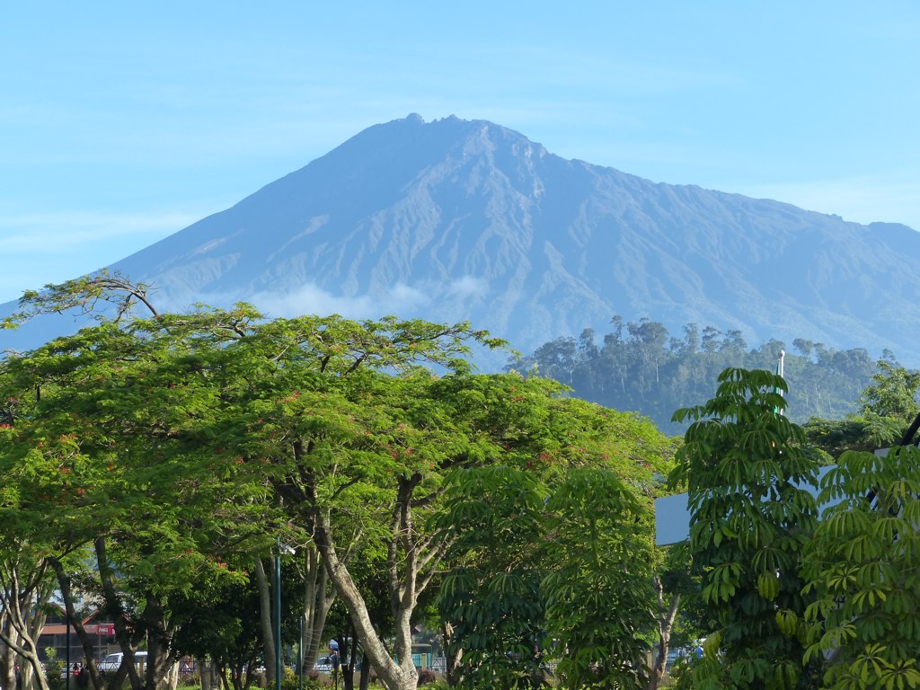
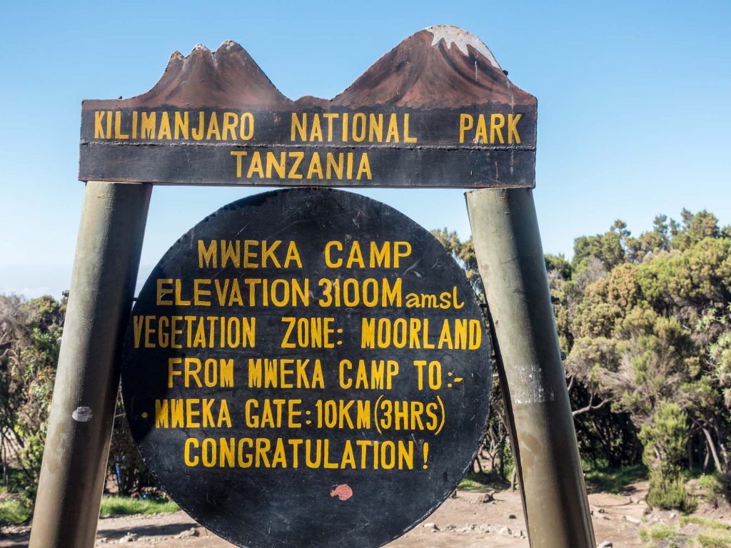
Highlights Kilimanjaro Trekking, Your Seven and Eight-day programs are available, so you can choose depending on the amount of time at your disposal. Longer programs are always recommended over the shorter ones for better acclimatisation. 6 and 7-day Lemosho programs start from a high-altitude drop-off: you’ll be transferred to the elevation of 3,500 m/ 11,500 f by an off-road vehicle and start the hike from there. This is meant to maximize acclimatization transition – the higher you start, the easier your adaptation will be. Kilimanjaro Trekking Detailed Itinerary Day 1: Londorossi Gate to Mti Mkubwa Elevation: 7,742 ft to 9,498 ft – Hiking Time: 3-4 hours Distance: 6 km | 4 miles Habitat: Rain-Forest We depart Arusha for Londorossi Gate, which takes about 4 hours, where you will complete entry formalities. Then drive to the Lemosho trailhead. Upon arrival at trailhead, we begin hiking through undisturbed forest which winds to the first camp site. Day 2: Mti Mkubwa to Shira 1 Camp Elevation: 9,498 ft to 11,500 ft – Hiking Time: 5-6 hours Distance: 8 km | 5 miles Habitat: Health We continue on the trail leading out of the rain forest and into a savannah of tall grasses, heather and volcanic rock draped with lichen beards. As we ascend through the lush rolling hills and cross several streams, we reach the Shira Ridge before dropping gently down to Shira 1 Camp. Here we catch our first glimpse of Kibo across the plateau. Day 3: Shira 1 Camp to Moir Camp Elevation: 11,500 ft to 13,800 ft – Hiking Time: 5-7 hours Distance: 11 km | 7 miles Habitat: Health We explore the Shira Plateau for a full day. It is a gentle walk east on moorland meadows towards Shira 2 Camp. Then we divert from the main trail to Moir Hut, a little used site on the base of Lent Hills. A variety of walks are available on Lent Hills making this an excellent acclimatization opportunity. Shira Plateau is one of the highest plateaus on earth. Day 4: Moir Hut to Lava Tower to Barranco Camp Moir Hut to Lava Tower Elevation: 13,800 ft to 15,190 ft – Hiking Time: 4-5 hours Lava Tower to Barranco Camp Elevation: 15,190 ft to 13,044 ft – Hiking Time: 2-3 hours Distance: 7 km | 4 miles Habitat: Alpine Desert Distance: 3 km | 2 miles Habitat: Alpine Desert We begin the day climbing up a ridge and then head southeast towards the Lava Tower – a 300 ft tall volcanic rock formation. We descend down to Barranco Camp through the strange but beautiful Senecio Forest to an altitude of 13,000 ft. Although you begin and end the day at the same elevation, the time spent at higher altitude is very beneficial for acclimatisation. Day 5:Barranco Camp to Karanga Camp Elevation: 13,044 ft to 13,106 ft – Hiking Time: 4-5 hours Distance: 5 km | 3 miles Habitat: Alpine Desert We begin the day by descending into a ravine to the base of the Great Barranco Wall. Then we climb the non-technical but steep, nearly 900 ft cliff. From the top of the Barranco Wall we cross a series of hills and valleys until we descend sharply into Karanga Valley. One more steep climb up leads us to Karanga Camp. This is a shorter day meant for acclimatization. Day 6: Karanga Camp to Barafu Camp Elevation: 13,106 ft to 15,331 ft – Hiking Time: 4-5 hours Distance: 4 km | 2 miles Habitat: Alpine Desert We leave Karanga and hit the junction which connects with the Mweka Trail. We continue up to the rocky section to Barafu Hut. At this point, you have completed the Southern Circuit, which offers views of the summit from many different angles. Here we make camp, rest and enjoy an early dinner to prepare for the summit day. The two peaks of Mawenzi and Kibo are viewable from this position. Day 7: Barafu Camp to Uhuru Camp to Mweka Camp Barafu Camp to Uhuru Peak Elevation: 15,331 ft to 19,341 ft – Hiking Time: 7-8 hours Uhuru Peak to Mweka Camp Elevation: 19,341 ft to 10,065 ft – Hiking Time: 4-6 hours Distance: 5 km | 3 miles Habitat: Arctic Distance: 12 km | 7 miles Habitat: Rain Forest Very early in the morning (around midnight), we begin our push to the summit. This is the most mentally and physically challenging portion of the trek. The wind and cold at this elevation and time of day can be extreme. We ascend in the darkness for several hours while taking frequent, but short, breaks. Near Stella Point (18,900 ft), you will be rewarded with the most magnificent sunrise you are ever likely to see coming over Mawenzi Peak. Finally, we arrive at Uhuru Peak- the highest point on Mount Kilimanjaro and the continent of Africa. From the summit, we now make our descent continuing straight down to the Mweka Hut camp site, stopping at Barafu for lunch. The trail is very rocky and can be quite hard on the knees; trekking poles are helpful. Mweka Camp is situated in the upper forest and mist or rain can be expected in the late afternoon. Later in the evening, we enjoy our last dinner on the mountain and a well-earned sleep. Day 8: Mwak Camp to Mweka Gate Elevation: 10,065 ft to 5,380 ft – Hiking Time: 3-4 hours Distance: 10 km | 6 miles Habitat: Rain Forest On our last day, we continue the descent to Mweka Gate and collect the summit certificates. At lower elevations, it can be wet and muddy. From the gate, we continue another hour to Mweka Village. A vehicle will meet us at Mweka Village to drive us back to the hotel in Moshi. WHATS INCLUDED? All Entrance fees and Government taxes Airport Transfers (upon Arrival and Departure) Clean, purified drinking water Fair wages for the mountain crew. All meals while on the Mountain Rescue Fees and all taxes. Salaries for Porters, Cook,

Kilimanjaro Trekking
trekking and hikking

Kilimanjaro Trekking – Umbwe Route (8 Days)

Safari Highlights Kilimanjaro Trekking, Daring experienced climbers seeking adventure and challenge will find just what they want on Umbwe. A short steep climb traversing all the climate zones – from tropical rainforest to eternal ice – will put your strength and endurance to the test. Like no other route on Kilimanjaro Umbwe gives a sense of achievement to those who reach the summit. Kilimanjaro Trekking, Your first day on the mountain will start from Umbwe Gate and continue with a lengthy trek to the first camp on your way – Umbwe camp. In spite of the challenge that Umbwe poses to hikers, well thought-out location of camps will contribute to proper acclimatization. Kilimanjaro Trekking Detailed Itinerary Day 1: Umbwe Gate to Umbwe Camp Elevation: 5,249 ft to 9,514 ft – Hiking Time: 5-7 hours Distance: 11 km | 7 miles Habitat: Health The day begins with a 50 minute drive to Machame Gate where registration formalities will be completed. We then transfer through villages and coffee and banana plantations to Umbwe Gate. The trail ascends sharply on a forestry track which winds up the dense rain -forest. The path narrows and steepens as we climb the ridge between two rivers surrounded by huge trees. Umbwe Camp is perched between trees and thick undergrowth. Day 2: Umbwe Camp to Barranco Camp Elevation: 9,514 ft to 13,044 ft – Hiking Time: 4-5 hours Distance: 6 km | 4 miles Habitat: Health The second day of the trek follows rockier terrain with sparse undergrowth and straggly, moss-covered trees. As we gain elevation, glimpses of Kilimanjaro can be seen. The path flattens as we approach Barranco Valley. From Umbwe ridge, the route descends to Barranco Camp through the strange but beautiful Senecio Forest. Day 3: Barranco Camp Elevation: 13,044 ft Habitat: Alpine Desert Extra Day for Acclimatization. Adding this day will ease your effort, and amplify your acclimatization. Day 4: Barranco Camp to Karanga Camp Elevation: 13,044 ft to 13,106 ft – Hiking Time: 4-5 hours Distance: 5 km | 3 miles Habitat: Alpine Desert We begin the day by descending into a ravine to the base of the Great Barranco Wall. Then we climb the non-technical but steep, nearly 900 ft cliff. From the top of the Barranco Wall we cross a series of hills and valleys until we descend sharply into Karanga Valley. One more steep climb up leads us to Karanga Camp. This is a shorter day meant for acclimatization. Day 5: Karanga Camp to Barafu Camp Elevation: 13,106 ft to 15,331 ft – Hiking Time: 4-5 hours Distance: 4 km | 2 miles Habitat: Alpine Desert We leave Karanga and hit the junction which connects with the Mweka Trail. We continue up to the rocky section to Barafu Hut. At this point, you have completed the Southern Circuit, which offers views of the summit from many different angles. Here we make camp, rest and enjoy an early dinner to prepare for the summit day. The two peaks of Mawenzi and Kibo are viewable from this position. Day 6: Barafu Camp to Uhuru Peak to Mweka Camp Barafu Camp to Uhuru Peak Elevation: 15,331 ft to 19,341 ft – Hiking Time: 7-8 hours Uhuru Peak to Mweka Camp Elevation: 19,341 ft to 10,065 ft – Hiking Time: 4-6 hours Distance: 5 km | 3 miles Habitat: Arctic Distance: 12 km | 7 miles Habitat: Rain Forest Very early in the morning (around midnight), we begin our push to the summit. This is the most mentally and physically challenging portion of the trek. The wind and cold at this elevation and time of day can be extreme. We ascend in the darkness for several hours while taking frequent, but short, breaks. Near Stella Point (18,900 ft), you will be rewarded with the most magnificent sunrise you are ever likely to see coming over Mawenzi Peak. Finally, we arrive at Uhuru Peak- the highest point on Mount Kilimanjaro and the continent of Africa. From the summit, we now make our descent continuing straight down to the Mweka Hut camp site, stopping at Barafu for lunch. The trail is very rocky and can be quite hard on the knees; trekking poles are helpful. Mweka Camp is situated in the upper forest and mist or rain can be expected in the late afternoon. Later in the evening, we enjoy our last dinner on the mountain and a well-earned sleep. Day 7: Mwak Camp to Mweka Gate Elevation: 10,065 ft to 5,380 ft – Hiking Time: 3-4 hours Distance: 10 km | 6 miles Habitat: Rain-Forest On our last day, we continue the descent to Mweka Gate and collect the summit certificates. At lower elevations, it can be wet and muddy. From the gate, we continue another hour to Mweka Village. A vehicle will meet us at Mweka Village to drive us back to the hotel in Moshi. Day 8: Mwak Camp to Mweka Gate Elevation: 10,065 ft to 5,380 ft – Hiking Time: 3-4 hours Distance: 10 km | 6 miles Habitat: Rain-Forest On our last day, we continue the descent to Mweka Gate and collect the summit certificates. At lower elevations, it can be wet and muddy. From the gate, we continue another hour to Mweka Village. A vehicle will meet us at Mweka Village to drive us back to the hotel in Moshi. WHATS INCLUDED? All Entrance fees and Government taxes Airport Transfers (upon Arrival and Departure) Clean, purified drinking water Fair wages for the mountain crew. All meals while on the Mountain Rescue Fees and all taxes. Salaries for Porters, Cook, and Guides Oxygen Tanks, Pulse Oximeter, and First Aid Kit WHATS EXCLUDED? International and local airfare. Yellow fever vaccinations Passport, Visa, and Travelers Insurance Local transportation before and after the climb. Personal expenses eg. Laundry, beverages, etc. Tips for the support team Private Toilet and hot shower tent Bed, Sleeping Bag, and walking Poles. Book Now

Kilimanjaro Trekking
trekking and hikking

Kilimanjaro Trekking – Rongai Route (7 Days)

Highlights Kilimanjaro Trekking, Rongai is the only route starting on the northern slope of Kilimanjaro. Though this part of the Mountain is rarely visited by hikers, it is not less interesting than the popular southern and western slopes. We recommend Rongai to all those who like reclusive hiking experiences. Kilimanjaro Trekking, Rongai is also the only route that passes by Mawenzi, one of the three volcanic cones of Kilimanjaro and the third highest peak in Africa. The way back lies through Marangu, and thus you will be able to see both sides of the mountain. Though six and seven-day programs are available, a longer option is recommended for better acclimatization transition. Kilimanjaro Trekking Detailed Itinerary Day 1: Rongai Gate to Rongai Cave Elevation: 6,398 ft to 9,300 ft – Hiking Time: 3-4 hours Distance: 8 km | 5 miles Habitat: Rain-Forest We drive from Moshi to Marangu Gate for permits before taking a short transfer to the Rongai Gate trailhead. The path winds through corn and potato fields and then climbs gently through the forest which is home to a variety of wildlife, including the black and white colobus monkey. Day 2: Rongai Cave to Second Cave to Kikelelwa Cave Rongai Cave to to Second Cave Elevation: 9,300 ft to 11,300 ft – Hiking Time: 3-4 hours Second Cave to Kikelewa Cave Elevation: 11,300 ft to 11,811 ft – Hiking Time: 3-4 hours Distance: 6 km | 4 miles Habitat: Health Distance: 6 km | 4 miles Habitat: Health We begin this morning with a steady incline up to Second Cave. We continue trekking though moorland, leaving the main trail for a smaller path towards the jagged peaks of Mawenzi, before finally arriving at Kikelewa Cave for the night. Day 3: Kikelewa Cave to Mawenzi Tarn Elevation: 11,811 ft to 14,160 ft – Hiking Time: 3-4 hours Distance: 5 km | 3 miles Habitat: Alpine Desert The hike today is short and steep up a grassy slope. Views of the wilderness area are stunning. As we exit the heath zone and emerge into the Alpine Desert zone, the landscape changes dramatically. Our camp is situated beneath the jagged spires of Mawenzi, at Mawenzi Tarn. The remainder of the day can be spent relaxing or exploring the area. Day 4: Mawenzi Tarn to Mawenzi Ridge to Mawenzi Tarn Mawenzi Tarn to Mawenzi Ridge Elevation: 14,160 ft -14,400 ft – Hiking Time: 1-2 hours Mawenzi Ridge to Mawenzi Tarn Elevation: 14,400 ft -14,160 ft – Hiking Time: 1-2 hours Distance: 2 km | 1 miles Habitat: Alpine Desert Distance: 2 km | 1 miles Habitat: Alpine Desert This is an extra day meant for acclimatization and can be spent day hiking on Mawenzi Ridge. The unique landscape offers motivating views of Kibo and Mawenzi. After spending a few moments exploring the area we head back to Mawenzi Tarn for camp. Day 5: Mawenzi Tarn to Kibo Hut Elevation: 14,160 ft to 15,430 ft – Hiking Time: 5-6 hours Distance: 8 km | 5 miles Habitat: Alpine Desert We climb gradually, then cross the lunar desert of the “Saddle” between Mawenzi and Kibo. Our camp, Kibo Hut, sits at the bottom of the Kibo crater wall. Once here we rest, enjoy an early dinner to prepare for the summit day. Day 6: Kibo Hut ot Uhuru Peak to Horombo Hut School Hut to Uhuru Peak Elevation: 15,430 ft to 19,341 ft – Hiking Time: 6-8 hours Uhuru Peak to Horombo Hut Elevation: 19,341 ft to 12,250 ft – Hiking Time: 4-5 hours Distance: 6 km | 4 miles Habitat: Arctic Distance: 16 km | 10 miles Habitat: Health Very early in the morning (around midnight), we begin our push to the summit. This is the most mentally and physically challenging portion of the trek. The wind and cold at this elevation and time of day can be extreme. We ascend in the darkness for several hours while taking frequent, but short, breaks. At Gilman’s point (18,600 ft), you will be rewarded with the most magnificent sunrise you are ever likely to see coming over Mawenzi Peak. Finally, we arrive at Uhuru Peak- the highest point on Mount Kilimanjaro and the continent of Africa. After spending a few moments taking in the plains of Africa and your accomplishment, we descend to Horombo Hut. Later in the evening, we enjoy our last dinner on the mountain and a well-earned sleep. Day 7: Horombo Hut to Marangu Gate Elevation: 12,205 ft to 6,046 ft – Hiking Time: 5-7 hours Distance: 20 km | 12 miles Habitat: Rain-Forest On our last day, we have a long trek mostly downhill through the tropical rainforest. Once at the park headquarters at Marangu gate, we collect our summit certificates. A vehicle will meet us here and drive us back to the hotel in Moshi. WHATS INCLUDED? All Entrance fees and Government taxes Airport Transfers (upon Arrival and Departure) Clean, purified drinking water Fair wages for the mountain crew. All meals while on the Mountain Rescue Fees and all taxes. Salaries for Porters, Cook, and Guides Oxygen Tanks, Pulse Oximeter, and First Aid Kit WHATS EXCLUDED? International and local airfare. Yellow fever vaccinations Passport, Visa, and Travelers Insurance Local transportation before and after the climb. Personal expenses eg. Laundry, beverages, etc. Tips for the support team Private Toilet and hot shower tent Bed, Sleeping Bag, and walking Poles. Book Now

Kilimanjaro Trekking
trekking and hikking

Kilimanjaro Trekking – Shira Route (6 Days)

Highlights Kilimanjaro Trekking, the second most popular option among the climbers is the Shira route, also known as “the Whiskey Route”. This route offers a wide variety of views, landscapes and experiences. The starting point of the route, Machame Gate, is only a 20-minute drive from Aishi Machame Hotel. Kilimanjaro Trekking, Located on the southern slope of Mt Kilimanjaro, Machame Gate will lead you to the top of Kilimanjaro along the exciting footpath which starts at the tropical forest, then runs through all the climate zones and finishes with the Arctic desert in the summit area. Kilimanjaro Trekking Detailed Itinerary Day 1: Machame Gate to Machame Camp Elevation: 5,380 ft to 9,350 ft Hiking Time: 5-7 hours Distance: 11 km | 7 miles Habitat: Rain Forest The drive from Moshi to the Machame Gate takes about 50 minutes. The journey passes through the village of Machame which is located on the lower slopes of the mountain. As we leave the park gate, we walk through the dense rain forest on a winding trail up a ridge until we reach the Machame Camp. Day 2: Machame Camp to Shira Camp Elevation: 9,350 ft to 12,500 ft Hiking Time: 4-6 hours Distance: 5 km | 3 miles Habitat: Health We leave the glades of the rain forest and continue on an ascending path up to a steep, rocky ridge. On the Shira Plateau, we pass through heather and open moorlands, then cross a large river gorge to Shira 2 Camp. Day 3: shira 2 camp to Lava Camp to Barranco Camp Elevation (ft): 12,500ft to 13,000ft Distance: 10 km Hiking Time: 6-8 hours Habitat: Semi Desert From the Shira Plateau, we continue to the east up a ridge, passing the junction towards the peak of Kibo. As we continue, our direction changes to the South East towards the Lava Tower, called the “Shark’s Tooth.” Shortly after the tower, we come to the second junction which brings us up to the Arrow Glacier at an altitude of 16,000ft. We now continue down to the Barranco Hut at an altitude of 13,000ft. Here we rest, enjoy dinner, and overnight. Although you end the day at the same elevation as when you started, this day is very important for Acclimatisation and will help your body prepare for summit day. Day 4: Barranco Camp to Karanga Camp Elevation: 13,000ft to 13,100ft Hiking time: 4-5 hours Distance: 3 miles Habitat: Alpine Desert After breakfast, we leave Barranco and continue on a steep ridge passing the Barranco Wall, to the Karanga Valley campsite. This is a short day meant for acclimatisation. Elevation: 13,000ft to 13,100ft Hiking time: 4-5 hours Distance: 3 miles Habitat: Alpine Desert. Day 5: Karanga Camp to Barafu Camp Elevation: 13,000 ft to 15,300ft Hiking time: 4-5 hours Distance: 2.5 miles Habitat: Alpine Desert After breakfast, we leave Karanga and hit the junction which connects with the Mweka Trail. We continue up to the Barafu Hut. At this point, you have completed the South Circuit, which offers views of the summit from many different angles. Here we make camp, rest, enjoy dinner, and prepare for the summit day. The two peaks of Mawenzi and Kibo are to be seen from this position. Day 6: Barafu Camp to Uhuru Camp to Mweka Camp Hiking time: 12 – 15 hours Distance: 3 miles to Summit; 7 miles descent Habitat: Arctic Very early in the morning (midnight to 2am), we continue our way to the summit between the Rebmann and Ratzel glaciers. You head in a northwesterly direction and ascend through heavy scree towards Stella Point on the crater rim. This is the most mentally and physically challenging portion of the trek. At Stella Point (18,600 ft), you will stop for a short rest and will be rewarded with the most magnificent sunrise you are ever likely to see (weather permitting). From Stella Point, you may encounter snow all they way on your 1-hour ascent to the summit. Day 6: Mweka Camp to Mweka Gate Elevation: 10,000ft to 5400ft Hiking time: 3-4 hours Distance: 6 miles Habitat: Rain Forest After breakfast, we continue the descent down to the Mweka Park Gate to receive your summit certificates. At lower elevations, it can be wet and muddy. Gaiters and trekking poles will help. Shorts and t-shirts will probably be plenty to wear (keep rain gear and warmer clothing handy). From the gate, you continue another hour to Mweka Village. A vehicle will meet you at Mweka village to drive you back to hotel in Moshi. WHATS INCLUDED? All Entrance fees and Government taxes Airport Transfers (upon Arrival and Departure) Clean, purified drinking water Fair wages for the mountain crew. All meals while on the Mountain Rescue Fees and all taxes. Salaries for Porters, Cook, and Guides Oxygen Tanks, Pulse Oximeter, and First Aid Kit WHATS EXCLUDED? International and local airfare. Yellow fever vaccinations Passport, Visa, and Travelers Insurance Local transportation before and after the climb. Personal expenses eg. Laundry, beverages, etc. Tips for the support team Private Toilet and hot shower tent Bed, Sleeping Bag, and walking Poles. Book Now

Kilimanjaro Trekking
trekking and hikking

Kilimanjaro Trekking – Machame Route (7 Days)

Highlights Kilimanjaro Trekking, the second most popular option among the climbers is the Machame route, also known as “the Whiskey Route”. This route offers a wide variety of views, landscapes and experiences. The starting point of the route, Machame Gate, is only a 20-minute drive from Aishi Machame Hotel. Kilimanjaro Trekking, Located on the southern slope of Mt Kilimanjaro, Machame Gate will lead you to the top of Kilimanjaro along the exciting footpath which starts at the tropical forest, then runs through all the climate zones and finishes with the Arctic desert in the summit area. Kilimanjaro Trekking Detailed Itinerary Day 1: Machame Gate to Machame Camp Elevation: 5,380 ft to 9,350 ft Hiking Time: 5-7 hours Distance: 11 km | 7 miles Habitat: Rain Forest The drive from Moshi to the Machame Gate takes about 50 minutes. The journey passes through the village of Machame which is located on the lower slopes of the mountain. As we leave the park gate, we walk through the dense rain forest on a winding trail up a ridge until we reach the Machame Camp. Day 2: Machame Camp to Shira Camp Elevation: 9,350 ft to 12,500 ft Hiking Time: 4-6 hours Distance: 5 km | 3 miles Habitat: Health We leave the glades of the rain forest and continue on an ascending path up to a steep, rocky ridge. On the Shira Plateau, we pass through heather and open moorlands, then cross a large river gorge to Shira 2 Camp. Day 3: shira 2 camp to Lava Camp to Barranco Camp Elevation (ft): 12,500ft to 13,000ft Distance: 10 km Hiking Time: 6-8 hours Habitat: Semi Desert From the Shira Plateau, we continue to the east up a ridge, passing the junction towards the peak of Kibo. As we continue, our direction changes to the South East towards the Lava Tower, called the “Shark’s Tooth.” Shortly after the tower, we come to the second junction which brings us up to the Arrow Glacier at an altitude of 16,000ft. We now continue down to the Barranco Hut at an altitude of 13,000ft. Here we rest, enjoy dinner, and overnight. Although you end the day at the same elevation as when you started, this day is very important for Acclimatisation and will help your body prepare for summit day. Day 4: Barranco Camp to Karanga Camp Elevation: 13,000ft to 13,100ft Hiking time: 4-5 hours Distance: 3 miles Habitat: Alpine Desert After breakfast, we leave Barranco and continue on a steep ridge passing the Barranco Wall, to the Karanga Valley campsite. This is a short day meant for acclimatisation. Elevation: 13,000ft to 13,100ft Hiking time: 4-5 hours Distance: 3 miles Habitat: Alpine Desert. Day 5: Karanga Camp to Barafu Camp Elevation: 13,000 ft to 15,300ft Hiking time: 4-5 hours Distance: 2.5 miles Habitat: Alpine Desert After breakfast, we leave Karanga and hit the junction which connects with the Mweka Trail. We continue up to the Barafu Hut. At this point, you have completed the South Circuit, which offers views of the summit from many different angles. Here we make camp, rest, enjoy dinner, and prepare for the summit day. The two peaks of Mawenzi and Kibo are to be seen from this position. Day 6: Barafu Camp to Uhuru Camp to Mweka Camp Hiking time: 12 – 15 hours Distance: 3 miles to Summit; 7 miles descent Habitat: Arctic Very early in the morning (midnight to 2am), we continue our way to the summit between the Rebmann and Ratzel glaciers. You head in a northwesterly direction and ascend through heavy scree towards Stella Point on the crater rim. This is the most mentally and physically challenging portion of the trek. At Stella Point (18,600 ft), you will stop for a short rest and will be rewarded with the most magnificent sunrise you are ever likely to see (weather permitting). From Stella Point, you may encounter snow all they way on your 1-hour ascent to the summit. Day 6: Mweka Camp to Mweka Gate Elevation: 10,000ft to 5400ft Hiking time: 3-4 hours Distance: 6 miles Habitat: Rain Forest After breakfast, we continue the descent down to the Mweka Park Gate to receive your summit certificates. At lower elevations, it can be wet and muddy. Gaiters and trekking poles will help. Shorts and t-shirts will probably be plenty to wear (keep rain gear and warmer clothing handy). From the gate, you continue another hour to Mweka Village. A vehicle will meet you at Mweka village to drive you back to hotel in Moshi. WHATS INCLUDED? All Entrance fees and Government taxes Airport Transfers (upon Arrival and Departure) Clean, purified drinking water Fair wages for the mountain crew. All meals while on the Mountain Rescue Fees and all taxes. Salaries for Porters, Cook, and Guides Oxygen Tanks, Pulse Oximeter, and First Aid Kit WHATS EXCLUDED? International and local airfare. Yellow fever vaccinations Passport, Visa, and Travelers Insurance Local transportation before and after the climb. Personal expenses eg. Laundry, beverages, etc. Tips for the support team Private Toilet and hot shower tent Bed, Sleeping Bag, and walking Poles. Book Now

Kilimanjaro Trekking
trekking and hikking

Kilimanjaro Trekking – Marangu Route (6 Days)

Highlights Kilimanjaro Trekking Marangu or “Coca-Cola” route is the most popular route on Kilimanjaro today. It is the only route where overnight stays are in huts. This makes Marangu a good option for hiking during the rainy season. Kilimanjaro Trekking Marangu Route, The route takes its start at the south-east of Mt Kilimanjaro. The entrance to the route, Marangu Gate, is quite close to our climbing base at Aishi Machame Hotel. The ride there takes about 1.5 hours. This route features a well-trodden trail running through all the climate zones – from tropical rainforest to eternal ice, and will also will treat you to scenic African landscapes. Kilimanjaro Trekking Detailed Itinerary Day 1: Marangu Gate to Mandara Hut Elevation: 6,046 ft to 8,858 ft Hiking Time: 4-5 hours Distance: 8 km | 5 miles Habitat: Rain Forest We depart Moshi for Marangu Gate for the necessary formalities before beginning our trek. The hiking trail begins by ascending a beautiful, tropical rain-forest. At the upper edge of the forest line, we have the opportunity to see blue monkeys. The trail then widens to expose beautiful hillsides until we reach Mandara Hut. Day 2: Mandara Hut – Horombo Hut Elevation: 8,858 ft to 12,205 ft Hiking Time: 6-8 hours Distance: 12 km | 7 miles Habitat: Health We start the day continuing through the forest until the trail opens into high moorland. We may get our first views of Kibo and Mawenzi peaks – two of the three volcanic peaks that make up the summit of Kilimanjaro. Day 3: Horombo hut-Mawenzi ridge-Horombo Hut Horombo Hut to Mawenzi Ridge Elevation: 12,205 ft to 14,400 ft – Hiking Time: 2-3 hours Mawenzi Ridge to Horombo Hut Elevation: 14,400 ft to 12,205 ft – Hiking Time: 1-2 hours Distance: 5 km | 3 miles Habitat: Heath Distance: 5 km | 3 miles Habitat: Health This is an extra day meant for acclimatization and can be spent day hiking on Mawenzi Ridge. The unique landscape offers motivating views of Kibo and Mawenzi. After spending a few moments exploring the area we head back to Horombo Hut. Day 4: Horombo hut – Kibo Hut Elevation: 12,205 ft to 15,430 ft Hiking Time: 6-8 hours Distance: 10 km | 6 miles Habitat: Alpine Desert We climb gradually, then cross the lunar desert of the “Saddle” between Mawenzi and Kibo. Our camp, Kibo Hut, sits at the bottom of the Kibo crater wall. Once here we rest, enjoy an early dinner to prepare for the summit day. Day 5: Kibo Hut – Uhuru Peak – Horombo Hut Kibo Hut to Uhuru Peak Elevation: 15,430 ft to 19,341 ft Hiking Time: 6-8 hours Uhuru Peak to Horombo Hut Elevation: 19,341 ft to 12,250 ft Hiking Time: 4-5 hours Distance: 6 km | 4 miles Habitat: Arctic Distance: 16 km | 10 miles Habitat: Health Very early in the morning (around midnight), we begin our push to the summit. This is the most mentally and physically challenging portion of the trek. The wind and cold at this elevation and time of day can be extreme. We ascend in the darkness for several hours while taking frequent, but short, breaks. At Gilman’s point (18,600 ft), you will be rewarded with the most magnificent sunrise you are ever likely to see coming over Mawenzi Peak. Finally, we arrive at Uhuru Peak- the highest point on Mount Kilimanjaro and the continent of Africa. After spending a few moments taking in the plains of Africa and your accomplishment, we descend to Horombo Hut. Later in the evening, we enjoy our last dinner on the mountain and a well-earned sleep. Day 6: Horombo Hut – Marangu Gate Kibo Hut to Uhuru Peak Elevation: 15,430 ft to 19,341 ft Hiking Time: 6-8 hours Uhuru Peak to Horombo Hut Elevation: 19,341 ft to 12,250 ft Hiking Time: 4-5 hours Distance: 6 km | 4 miles Habitat: Arctic Distance: 16 km | 10 miles Habitat: Health Very early in the morning (around midnight), we begin our push to the summit. This is the most mentally and physically challenging portion of the trek. The wind and cold at this elevation and time of day can be extreme. We ascend in the darkness for several hours while taking frequent, but short, breaks. At Gilman’s point (18,600 ft), you will be rewarded with the most magnificent sunrise you are ever likely to see coming over Mawenzi Peak. Finally, we arrive at Uhuru Peak- the highest point on Mount Kilimanjaro and the continent of Africa. After spending a few moments taking in the plains of Africa and your accomplishment, we descend to Horombo Hut. Later in the evening, we enjoy our last dinner on the mountain and a well-earned sleep. WHATS INCLUDED? All Entrance fees and Government taxes Airport Transfers (upon Arrival and Departure) Clean, purified drinking water Fair wages for the mountain crew. All meals while on the Mountain Rescue Fees and all taxes. Salaries for Porters, Cook, and Guides Oxygen Tanks, Pulse Oximeter, and First Aid Kit WHATS EXCLUDED? International and local airfare. Yellow fever vaccinations Passport, Visa, and Travelers Insurance Local transportation before and after the climb. Personal expenses eg. Laundry, beverages, etc. Tips for the support team Private Toilet and hot shower tent Bed, Sleeping Bag, and walking Poles. Book Now

Kilimanjaro Trekking
trekking and hikking

Mount Meru Trekking (4 Days)

Highlights Mt. Meru may not be a name which enjoys the same international recognition as mighty Mount Kilimanjaro, 80km to the east. But whether you are training for an ascent of Africa’s highest peak, or targeting Meru as your primary goal, this really is an experience to treasure. At a lofty 4566 metres, this is a great challenge in its own right. You can expect to see some wildlife on the lower slopes, maybe some buffalo, elephant or giraffe, perhaps even – if you are very lucky – hyena or leopard. Bird-lovers will also find lots to interest them. Mount Meru Trekking Detailed Itinerary Day 1: Momella Gate to Mariakamba Hut Elevation: 4,921 ft to 8,250 ft – Hiking Time: 4-6 hours Distance: 14 km | 9 miles Habitat: Rain Forest We depart Moshi or Arusha for Momella Gate in Arusha National Park for the necessary formalities before beginning our trek. The hiking trail begins in open grassland with an armed ranger as the possibility of seeing wildlife – giraffe, zebras, antelope, elephant and buffalo – is high. Our hike on the Southern Route takes us through the rain forest to Maio Waterfalls and Fig Tree Arch until we reach Miriakamba Huts, situated in a grassy glade. Day 2: Mariakamba Hut to Saddle Hut Elevation: 8,250 ft to 11,712 ft – Hiking Time: 3-5 hours Distance: 6 km | 3 miles Habitat: Health We continue climbing through the rain forest until we enter the heath zone accompanied by giant heather and other moorland vegetation. Along the ridge of the saddle, we have views of Mount Meru Crater and the Ash-Tray. After arriving at Saddle Huts, there is an option to hike to the top of Little Mount Meru for superb views and to further aid acclimatization. Day 3: Saddle Hut – Summit – Mariakamba Hut Saddle Huts to Summit Elevation: 11,712 ft to 14,977 ft – Hiking Time: 4-6 hours Summit to Miriakamba Huts Elevation: 14,977 ft to 8,250 ft – Hiking Time: 4-6 hours Distance: 6 km | 4 miles – Habitat: Alpine Desert Distance: 12 km | 7 miles – Habitat: Health Very early in the morning (around midnight), we begin our climb to the summit. The trail is steep to Rhino Point and then Cobra Point. The path continues along the ridge of ash and rock to the summit – Socialist Peak. Here we enjoy magnificent views of Kilimanjaro and the sunrise before returning to Miriakamba Huts. Day 3: Mariakamba Hut – Momella Gate Elevation: 11,712 ft to 4,921 ft – Hiking Time: 2-4 hours Distance: 7 km | 4 miles Habitat: Rain Forest On our last day, we descend quickly through the tropical rainforest to Momella Gate. At the base of the mountain, our vehicle will meet us and drive us back to the hotel in Arusha or Moshi. WHATS INCLUDED? All Entrance fees and Government taxes Airport Transfers (upon Arrival and Departure) Clean, purified drinking water Fair wages for the mountain crew. All meals while on the Mountain Rescue Fees and all taxes. Salaries for Porters, Cook, and Guides Oxygen Tanks, Pulse Oximeter, and First Aid Kit WHATS EXCLUDED? International and local airfare. Yellow fever vaccinations Passport, Visa, and Travelers Insurance Local transportation before and after the climb. Personal expenses eg. Laundry, beverages, etc. Tips for the support team Private Toilet and hot shower tent Bed, Sleeping Bag, and walking Poles. Book Now

African Luxury Tanzania Safari
trekking and hikking

Ol Doinyo Lengai Trekking (3 Days)

Highlights Oldonyo Lengai is a Maasai name meaning the “Mountain of God” is an active volcanic mountain in Eastern of Rift Valley and the only active volcanic mountain in the world that produce Natrocarbonatite Lava. Its approximately 4 Hours drives from Arusha to Oldoinyo Lengai Mountain. Ol Doinyo Lengai Trekking Detailed Itinerary Day 1: Arrival in Tanzania After breakfast you will have comprehensive briefing about your safari then depart Lake Natron which will take 5-6 hours driving from Arusha. lunch will be served at the picnic site then climbing Oldonyo lengai Mountain will start at night in order to explore African sky during night climbing will take 4-6 hours climbing, 2-3 hours descent. Day 2: Lake Natron Today, probably you will descent at late morning the car will pick you and drive back to the camps for your hot lunch late afternoon you visit Engaresero river waterfalls and explore the flamingos at Lake Natron then back to camps for Dinner and Overnight.Today, probably you will descent at late morning the car will pick you and drive back to the camps for your hot lunch late afternoon you visit Engaresero river waterfalls and explore the flamingos at Lake Natron then back to camps for Dinner and Overnight. Day 3: Lake Natron to Arusha After breakfast, your safari continues to the Ngorongoro Crater, a UNESCO World Heritage Site. This is the world’s largest caldera, a feature formed by the collapse of land after a volcanic eruption. It is approximately 18 km in diameter and home to about 25,000 mammals. After lunch at a picnic spot, there will be more time to continue your game drive before you leave the crater and go to Twiga Lodges at Mto wa Mbu for night stay. WHATS INCLUDED? All Entrance fees and Government taxes Airport Transfers (upon Arrival and Departure) Clean, purified drinking water Fair wages for the mountain crew. All meals while on the Mountain Rescue Fees and all taxes. Salaries for Porters, Cook, and Guides Oxygen Tanks, Pulse Oximeter, and First Aid Kit WHATS EXCLUDED? International and local airfare. Yellow fever vaccinations Passport, Visa, and Travelers Insurance Local transportation before and after the climb. Personal expenses eg. Laundry, beverages, etc. Tips for the support team Private Toilet and hot shower tent Bed, Sleeping Bag, and walking Poles. Book Now

Scroll to Top